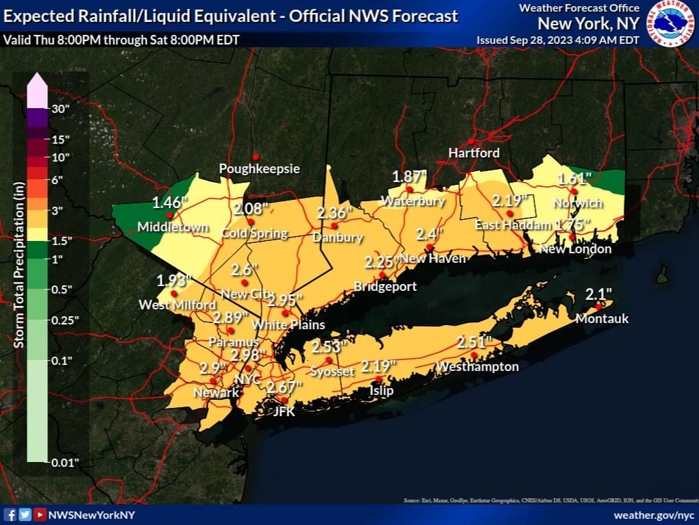
From The National Weather Service – A slow moving coastal low will bring moderate to heavy rain, gusty winds, minor coastal flooding and beach erosion to the area Tonight into Saturday.
Total Rainfall – A widespread 2 to 3 inches of rain is likely late tonight into Saturday, much of this falling early Friday morning into Friday evening. Locally 3-5″ of rainfall is possible, but confidence on occurrence and location is low at this point.
Rainfall Rates – There is a low probability of rainfall rates reaching 1″/hr and/or 3″/3hr on Friday.
Impacts: This event presents an areawide minor urban, poor drainage, and low lying area flooding threat, as well as a minor quick responding river/stream flood threat early Friday morning into Friday evening. Isolated to scattered instances of flash flooding are possible if the locally heavy rainfall amounts are realized, but confidence is low on this at this time. Monitor subsequent forecasts, as the rainfall and flood impacts forecast will be refined over the next 24 hours.
Minor coastal flooding causing flooding up to 1 1/2 ft above ground level is expected for the most vulnerable NY/NJ harbor, Jamaica Bay, western Great South Bay, and coastal Westchester and Fairfield communities for tonight, Fri AM, Fri PM and likely the Sat AM high tidal cycles. Elsewhere, localized minor coastal flooding is likely.
Additional rounds of minor coastal flooding are possible for the remainder of the weekend tidal cycles.
Continued ocean beach erosion/escarpment from 4 to 7 ft breaking surf will continue through at least Saturday, particularly during the times of high tide.